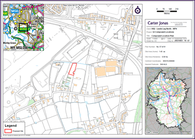
Carter Jonas are experts in producing customised maps and plans that support all aspects of property management.
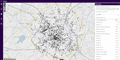
From residential sales and lease plans to environmental constraints, our mapping and analysis team take the time to understand your specific requirements and translate them into digital or printed maps that help you to better manage or understand your property.Using the latest in geospatial mapping and analysis software, we make the complex problems simple. From finding the ideal site for your future property investment to understanding how people interact with a city’s existing infrastructure, our analysts help you visualise and contextualise the information to provide real insight.
Our mapping services

- Conveyance mapping – land registry compliant plans, including sale plans and rural and commercial lease plans (FBTs (farm business tenancies), AHAs (Agricultural Holdings Act tenancies), floorplans)
- Estate mapping – complex estate plans, covering estate tenure, sporting rights, land use, asset location
- Bespoke mapping services – environmental constraints mapping, planning application submission plans, land access plans, rural payment agency submission plans, easement and wayleaves plans
- Data capture – digitising land features from paper hard sources, with results shared in GIS (Geographic Information System) / CAD formats or as a web GIS Service
Our analysis services

- Site finding >
- Crowd sourced data gathering
- Solar and wind farm site finding
- Asset relocation
- Origin destination analysis
- Planning monitoring
@
Get in touch
Alex is an Associate within the Infrastructure Division at Carter Jonas and manager of a GIS Production Team of four experienced technicians. Alex has extensive geospatial data management and analysis knowledge with a strong consultancy skill set. He is very proficient in using and applying several important GIS Datasets: HM Land Registry. Ordnance Survey, DEFRA, ONS, CENSUS, etc. He is also experienced in using Online GIS to deliver bespoke GIS Applications and Dashboards.
Keep informed
Sign up to our newsletter to receive further information and news tailored to you.


